Tuesday, July 5, 2016
Wednesday, July 6, 2016
Overnight backing trip to the San Pedro Parks Wilderness (SPPW) near Cuba, New Mexico. Hiked three trails: the Vacas Trail (#51), Damian Trail (#436), and the Palomas Trail (#50).
Drove up to Cuba, New Mexico on Hwy. 550, made a stop at the local McDonalds, then headed out Hwy. 126. About 7.5 miles from Cuba, we turned left on Forest Road 70 (watch for the San Gregorio Reservoir sign) and drove the 2.5 miles of gravel road to the parking area for the Vacas Trailhead and San Gregorio Reservoir. Gravel road was in pretty good shape, much better than I remembered. Parking area is well maintained. Elevation around 9,240 feet. Room enough for a dozen or so cars. Clean pit toilets. No entrance fee. No parking fee. Trailhead is right on Forest Road 70, a very short walk from the parking area.
This was our second backpacking trip to the SPPW. For the first trip, back in 2012: Click Here
A few words about a map for this area. Some trail names have changed, and some trail routes have changed. Older maps from the USGS, which are the same maps you get from a place like mytopo.com, reflect old information. For an updated map, you need to buy the US Forest Service map: San Pedro Parks Wilderness. This map is a water-resistant, 24k map with UTM grid lines and reflects any updated trail names and routes. The map only costs $14 — if you buy from the forest service, either at a local forest service office or order online. If you live in ABQ, there is a forest service office on Osuna Road, about a block north of Osuna and Chappell. However, if you are a fan of REI’s price-gouging tactics, you can buy that map from them for $17.
From the trailhead, it is a one mile hike along the Vacas Trail (#51) to the reservoir. The Vacas Trail is well-traveled and very easy to follow, not only up to the reservoir, but for its entire length. And as mentioned on my prior trip out here, the reservoir is a popular fishing spot for the locals, although we only spotted a few people fishing on this trip. My hiking partner, Marty, told me that “vacas” means “cows”. Take it from me, the trail (and all of the SPPW) is appropriately named because we ran across numerous cows on this trip! 🙂
A little over a mile from the reservoir is the cutoff for the Damian Trail (#436) and the Vallecito Damian. Elevation at the cutoff is 9,600 feet. The trail disappeared as we approached the vallecito (little valley), which is not uncommon for the open areas out here. In fact, the “Parks” part of San Pedro “Parks” Wilderness refers to all the open areas you encounter throughout the SPPW. These open areas tend to be covered in tall grass and skunk cabbage and can get quite boggy/marshy/muddy during/after a rain — and the week prior to our arrival was a heavy rain week for the SPPW. Now factor in all the cattle, which favor the open, grassy areas, and the ground can get churned up pretty good.
Once we crossed the vallecito, we relocated the trail and began the climb up and out of the valley. The climb is around 600 feet at grades up to 18% or so and gave us a pretty good workout. Another thing to be aware of in the SPPW is dead-fall and blow-down, and we encountered plenty of that on this trip, quite often blocking the trail. Not only on this trail, but on the other trails, as well.
After making the climb out of the vallecito to 10,019 feet, about 3.2 miles into the hike, we made the descent to the Rio de las Vacas, our first of two stream crossings. Actually, there were multiple stream crossings on this trip, but only two that might require water shoes. These two stream crossings are nothing major, this one was about 15 feet wide, less than a foot deep, and did no require water shoes. However, with slippery rocks, you still have to be very careful of your footing or risk taking a fall. In fact, if you watch the video, Marty’s less-than-graceful attempt to cross this stream will drive home that point. He is very lucky he didn’t get hurt on this crossing! 🙂
Stream crossing behind us, we continued on. This part of the hike — from here to the Palomas Trail — covers a lot of open ground, meaning, for the most part, the trail was nowhere to be found! However, the forest service has put posts up as a guide. The posts aren’t really that close together, so you have to look for them, and some of them aren’t that easy to spot. Not a big deal, really, you just have to be a bit eagle-eyed as you work your way east!
The Damian Trail ends where it meets the Palomas Trail (#50), 4.8 miles into the hike at an elevation of 9,748 feet. This intersection is only a short distance north of where the Perchas Trail (#32) intersects the Palomas Trail. We hiked the Perchas back when we did the Penas Negras / Perchas / Palomas Trails dayhike some years ago.
We headed north on the Palomas Trail and were prepared to make another steep climb right off the bat, but it turned out to be much less than expected. The Palomas Trail is easy to follow and only once or twice did we lose the trail through some marshy areas. Three miles up and we merged with the Vacas Trail. This is where the Palomas Trail ends. Another third of a mile on the Vacas Trail and we arrived at our destination for the night — a total of 7.9 miles of hiking for the day. We trudged around for a while looking or a good campsite and finally found a fairly nice place in the woods, a stone’s throw from the Rio de las Vacas, at an elevation of 10,200 feet. Had to watch our step due to all the cattle in the area, which also means a lot of flies. Oh, well. You can’t have everything! 🙂
Next morning we headed back down the Vacas Trail, made the second of those stream crossings that might require water shoes (didn’t need them here, either), and followed the Vacas Trail all the way back down to the reservoir and the Vacas Trailhead. Not sure which trail had more dead-fall, the Vacas or the Damian, but there was a lot of dead-fall, oftentimes blocking the trail.
Total hiking for this trip was 13.7 miles, including about a third of mile while looking for a campsite. Total climbing was a little more than 2,000 feet. Although there were multiple stream crossings, none presented much of a challenge. However, be advised: If you come out here during snow melt, the small rivers and creeks you see in the video can become raging torrents of freezing cold water with no safe way for you to cross to the other side. Keep that in mind when planning your trip to the SPPW.
Now on to Cuba and El Bruno’s for lunch!! 🙂
Click the map and elevation profile for a larger view. Then click the icons on the map for more information. If the icon notes come up empty, you will have to reload the map.

SPPW Terrain Map and Trail Route

SPPW Elevation Profile
To view the video full-screen, click to play, then click the 4-cornered square at the bottom-right of the player.
 July 21, 2016
 George
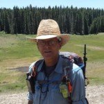

6 responses to “Backpacking: San Pedro Parks Wilderness ~ Cuba, New Mexico, USA”
Jenny
May 6th, 2018 at 21:23
I know this was published a couple years ago now, but as someone unfamiliar with the San Pedro Parks Wilderness I really appreciate this detailed report. The official government websites leaves much to be desired, so it was nice to stumble across your blog and video. Thanks!
George
May 6th, 2018 at 21:46
Hey, Jenny. Thanks for your nice comment! I’m glad to hear you found my SPPW hike report and video helpful. If you plan on hiking up there, keep in mind, the Santa Fe National Forest will go to Stage II fire restrictions tomorrow. I anticipate they will probably go Stage III (closure) in early June, so if you’re going to the SPPW, better try to go this month or you may not be able to go until monsoon starts up (assuming we have one this year). Safe hiking! 🙂
anna
July 27th, 2016 at 13:55
Thanks for the detailed report!!
Will be heading up next week to backpack in that area. Will be my first time to backpack in New Mexico. (We’re coming from Houston
George
July 27th, 2016 at 14:24
Hey, Anna!
You’re more than welcome… glad you found it useful!
Stage I fire restrictions for all of the Santa Fe National Forest (to include San Pedro Parks Wilderness) will be lifted tomorrow morning (2016-07-28). Extended forecast for Cuba, NM shows 40% and 60% chance of rain next Monday and Tuesday. so you may get wet. Beautiful country in the SPPW, but a lot of dead-fall and blow-down in some places. Still a good choice for your first backpacking trip in NM. I’m sure you will enjoy it.
El Buno’s, in Cuba, has some pretty good Mexican food. Good place to stop and eat after your hike. It’s about a block north of the Hwy. 126 turn there in Cuba.
BTW, I’m from D/FW. 🙂
Have a safe trip!
anna
July 28th, 2016 at 11:55
We have a firebug in our group, so good to know the fire restriction will be lifted!
Have been looking at that forecast……got a new frogg togg suit & backpack cover and also taking along a couple of tarps. Hoping that by being prepared for rain will ensure no/limited rain! (And NO LIGHTNING!)
Watched your video last night and now concerned about bears! That’s something I haven’t had to contend with in the past, but have encounter lots of bold raccoons and pica mice (in Alaska)
We’re also thinking of visiting Kasha-k? Tents rocks, Jemez Springs, Santa Fe and the Oasis (near Clovis)
Thanks for the restaurant recommendation! I saw that in your trip report 🙂
George
July 28th, 2016 at 13:16
About a month ago, a woman running a marathon in the Valles Caldera was attacked and mauled by a sow with cubs, but don’t recall hearing about any other bear attacks in NM since I moved out here five years ago. We’ve done a lot of hiking and some backpacking in Northern NM and SW Colorado and we have never seen a bear or lion in the wild. 😦 I think lions are more worrisome because they are so stealth, you wouldn’t even know one was near you until you felt it land on your back!