June 20-21, 2012
Yes, the date above is correct. It’s been almost a year since this trip and I’m just now getting this up! 🙂
Went on my first backpacking trip into the San Pedro Parks Wilderness (SPPW), which is ENE of Cuba, New Mexico. I chose the SPPW for my first backpacking experience because the elevation gain of about 1,000 feet comes in small chunks at minor grades, and water is plentiful. Since I’m not a big guy and I have a screw in my right ankle, I wanted to test myself wearing a heavier pack without having to do a lot of climbing and without having to carry more than a liter of water at at time. For this first trip, we decided on 2 days and 1 night.
Update: Did another overnight trip to the SPPW in July, 2016. For trip report, route map, and video: Click Here
Although my pack was heavier than it should have been, I handled it well, but not sure how much real climbing I could do with that kind of load… and not sure how to make it much lighter, either. But if you are going on your first backpacking trip and you are close to the SPPW, I highly recommend this area for a *tester* hike where you can gauge yourself and work the kinks out before taking on something more demanding.
Click here for the trail map, then click icons for more info. If Icons come up empty, you will have to reload the map.
Be advised, the topo map at the above link is using old trail names.
Click here for the day hike I did in San Pedro Parks Wilderness
My friend, Marty, and I drove up to Cuba, then took Hwy. 126 to the east. At the sign indicating San Gregorio Reservoir (Point A on map), we headed north on a rough gravel road, although not rough enough to warrant a 4WD vehicle. Around noon, and after 2.5 miles of gravel road, we reached the parking area and trail head (Point B on map) for the Vacas Trail (#51). This trail is named after the Rio de las Vacas, but you will have to hike about 5.5 miles in before you get your first glimpse of that very small river. Elevation at the trail head is 9,208 feet and we hiked up the Vacas Trail for about a mile and arrived at San Gregorio Reservoir (Point C on map). This was an easy trail with an elevation gain of 199 feet, total vertical climbing of 204 feet, and a grade of 3.5%.
As you will see in the pics, the area around the reservoir is beautiful. However, since it is only a mile hike, it gets heavy use by those who like to fish. Only saw a handful of people at the reservoir on the way up, but the place was crawling with people when we came back down. Reason enough to not linger at the reservoir! 🙂
We continued up the Vacas Trail, past the east side of the reservoir, for about another mile. At this point, there is a sign indicating the cutoff to the Damian Trail (#436) (Point D on map), which runs east for about 2.5 miles until it ends where it meets the intersection of the Palomas (#51) and Perchas (#418) Trails (not shown on map ~ I was at that intersection a couple of weeks ago when I did my Penas Negras (#32)/ Perchas / Palomas Trails open-loop hike). Elevation gain, total vertical climbing, and grade was about the same as it was from the trail head to the reservoir.
Leaving the Damian Trail cutoff sign behind, we hiked another 1.2 miles up the Vacas Trail until we reached the split (Point E on map). A sign indicated the left fork would put you on the Upper Clear Creek Trail (#417) and eventually the Lucero Trail (#34), and the right fork would be a continuation of the Vacas Trail. Elevation gain and total vertical climbing for this section of trail was about 400 feet, but the grade was close to 6%, so a little steeper than the first two legs but still not bad. The elevation gain for the rest of the hike was similar to the first two legs, so no need to deal with elevation again.
After a short rest stop, we took the right fork and pushed on up the Vacas Trail. Along the way, we crossed an unnamed stream where the water was crystal clear and we decided to refill our water bottles. This gave me a chance to use my Katadyn Pocket MicroFilter water pump for the first time. It worked like a charm and the water tasted great.
Another 2.3 miles and we crossed the Rio de las Vacas for the first time. Snow melt was long over and the river was clear, shallow and narrow. At the river, the Vacas Trail merged with the Palomas Trail (Point F on map), forming a “T”. I was looking for this “T”, or so I thought, because our goal was to camp in this area for the night. Were we at the “T” I thought we were at? No. Did I realize we had dead-ended into the Palomas Trail? Yes. Did I realize the Palomas Trail was not the trail I thought it was? No. Should we have taken a right turn like I thought we should have? No. But we did make a right turn… which was the wrong turn… and headed off on the right trail… but in the wrong direction! 🙂
After hiking 0.3 miles and watching the trail lead us farther and farther away from the river, which it wasn’t supposed to do had we been at the “T” I thought we were at, I realized my mistake and we had to turn around and go back. Hey, it was only a 0.6-miles-round-trip-right-turn mistake, but it did remind me I needed to be careful about making assumptions. After recovering from this mistake, we had logged a little over six miles hiking for the day. We were running out of gas and needed to find a place to camp for the night.
Since our original plan was to make it to what we now knew was the second “T”, we pushed on up the Palomas Trail — in the right direction this time! Fortunately, it didn’t take us long to get there as it was only another 0.3 miles. We made our second crossing of the Rio de las Vacas and the Palomas Trail dead-ended into another trail forming the second “T” I had been looking for (Point G on map). At this *T*, the Vacas Trail continues to the right and the Anastacio Trail (#435) starts and goes off to the left. Finally!! After 6.4 miles of hiking, it was time to look around for a good place to pitch the tents.
And on the top of an east-facing rise, we found our spot, complete with furniture — a big, dead log we could use to sit on. Directly across from us was the Rio de las Vacas flowing through a wide valley with a grassy meadow, all backed up by a most enchanting dense forest and tree line. We couldn’t have hoped for anything more beautiful and relaxing. In the SPPW, what they call Rios, or rivers, are pretty small, more like streams, really. I could jump across the Rio de las Vacas and wouldn’t even need a running start.
Tents went up in a few minutes, standing at the ready for tired bodies in need of rest. Hiked the short distance to the river to refill our water bottles. Ate our fill of beef jerky, trail mix, granola bars and dried fruit, which, for me, wasn’t much because I tend not to get too hungry when hiking. Then spent the short evening relaxing, taking in the sights and enjoying the sounds of silence. We had the whole wilderness to ourselves. Well, until about eight when two guys fishing the Vacas showed up. Fortunately, they were camped a hundred yards of so from us, so their presence did not interfere with our peace and quiet.
The night was dark. The sky was bright even though there was no moon. The stars looked ten times brighter than they look when seeing them through the haze and lights of the city. The Milky Way ran across the sky like a glass of spilled milk. I could almost hear Carl Sagan recite the Pale Blue Dot from the decades-old PBS documentary, Cosmos. You could do nothing but stand in silence… stand in awe… pull it all in… soak it all up… sense the tug on your soul… then give in to that tug and suddenly feel connected to virtually everything in the universe. Magnificent! 🙂
Left all the food and scented items in the bear canister overnight. But no bears. No mountain lions. No critters of any kind. Well, Marty did see some kind of chipmunk… and the cows don’t count. As I said before, I think I am critter-challenged! Temps felt like they got down into the mid-30s that night, but I stayed warm and toasty in my sleeping bag. Slept late the next morning. Heard the early morning bellow of an elk, but no elk could be seen. Ate the same thing I ate the night before and called it breakfast. Marty cooked eggs just to make me envious! Then one final run to the river to fill water bottles. Broke camp and hit the trail around 10:30 AM.
Hiked 1.3 miles along the Anastacio Trail where we came across a sign that indicated we were at the cutoff for the Upper Clear Creek Trail (Point H on map). Yeah, right. The sign was in the middle of a big open area and pointed to the south. Since we were looking for the Upper Clear Creek Trail and knew it ran south, we left the Anastacio Trail and took off across open country in the direction the arrow on the sign had pointed.
Okay… take a break.
My hiking buddy and I had reservations about that sign. We both felt the cutoff we were looking for was on down the Anastacio Trail. I had my GPS with me, along with a topo map. My GPS was still new, having bought it only a few weeks prior to this trip, so I was still learning how to use it. I now know that before taking off in a questionable direction, I should have pulled out my topo map, created a waypoint on my GPS in order to get a fix on our location, and then plotted that location on the topo map. If I had, I would have seen that we were still about 300 feet or so from the actual cutoff (Point I on map), which we couldn’t see due to trees blocking our line of sight. So live and learn. Looking back, I think someone must have turned the sign. Hey, it gets me off the hook… well, partially! 😉
So we headed off in the wrong direction (again!) and after crossing the open area, we ended up going into the woods with no sign of any trail. It was at this point we knew the sign was wrong. However, we weren’t lost because we also knew from the map we would eventually cross the trail and I had the trail showing on my GPS. And this is where I realized my second mistake. Had I zoomed in on my GPS, I could have seen the sign was not the trail cutoff we were looking for. But I had my GPS zoomed out, which made it look like we were at the right place. So live and learn… again! 🙂
After hiking 0.8 miles through the woods, using compass and GPS as a guide, we finally found the Upper Clear Creek Trail. Another 1.5 miles south along the Upper Clear Creek Trail found us at the junction with the Lucero Trail (Point J on map), and after another 0.6 miles we were at the junction with the Vacas Trail (Point E on map) . Followed the Vacas Trail south until we reached the reservoir and on down to the trail head.
Total for the trip was 14.1 miles over two days and one night. Actual hiking time was 5.5 hours, with an average speed of 2.6 mph. Total climbing for this trip was 1, 675 feet, although the elevation gain was only about 1,000 feet. Elevation grades were minimal at 6% or less.
All in all, a very good beginner backpacking trip in one of the most beautiful areas in New Mexico. Enjoyed every minute of it, too. So much so, I hope to plan a longer backpacking trip to SPPW this year. To say I loved this place would be an understatement!! 🙂
If you decide to hike or backpack the SPPW, don’t buy a topo map from a place like mytopo.com because it will be more expensive, it will be an old map, and it will have the WRONG trail names. How do I know? I’ll give you one guess! Instead, go to a National Forest Service office (maybe even a National Parks office) and buy the National Forest Service’s San Pedro Parks Wilderness map. It only costs $10 and it is well worth it. Scale is 1:24k, contour lines are at 40 foot intervals, it’s water resistant, it’s a nice looking map, and it has the CORRECT trail names and numbers. REI carries the National Forest Service’s SPPW map, but it will cost you $17. I had the older map with the WRONG trail names, and even though we knew which trails to take, it was still very confusing. Don’t make the same mistake!! 😉
Like I said… it was a tester hike and I did work the kinks out!!!!!!
Here are the pics (taken with my old point-and-shoot). Click the first one to start the manual slideshow.


 June 3, 2013
 George
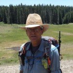

4 responses to “Backpacking: San Pedro Parks Wilderness ~ Santa Fe National Forest ~ Cuba, New Mexico, USA”
bubbasuess
June 3rd, 2013 at 10:24
Good stuff. That is a fun wilderness.
George
June 3rd, 2013 at 11:06
Yes, the place is beautiful! You seem to know a lot about this area… did you live here at some point?
bubbasuess
June 3rd, 2013 at 11:18
I went to graduate school in Texas, but I was in New Mexico backpacking all the time, since it was the closest real mountains I could get. I also dated a girl from Santa Fe at that time. I developed an abiding affection for the state and if I were not living here in Northern California, I would move my family out to New Mexico.
George
June 3rd, 2013 at 12:12
Okay… I figured there had to be a connection.
I left Texas 1 1/2 years ago. When I got to New Mexico, I realized the world wasn’t flat, after all. 🙂 That’s all it took for me to develop a bond with the mountains!