May 31, 2013
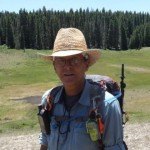
The ASCHG does an Oat/Hay Canyons Loop Hike in the Jemez Mountains at least once or twice during the season. The track for that hike leads up Oat Canyon and down Hay Canyon. Near the entrance to Hay Canyon, the track moves up along the bluffs, above and north of the entrance to Hay Canyon, and there is a rather steep descent from those bluffs in order to get down to the Cebolla Rio. An exploratory hike was setup by some of the ASCHG hike coordinators to scout the area for a safer passage and I was invited to tag along. Since I had never hiked that area before, I was all in. 🙂
Click Here to go to the trail map… then click on the individual icons for the trail notes. If icon notes come up empty, try reloading the map.
Drove up through Jemez Springs on Hwy. 4, then up Hwy. 126 to Forest Road 144. Then drove 6.8 miles up Forest Road 144 to the trailhead for Pony Canyon and Secret Canyon, where we parked. Secret Canyon is not on the map, it’s just a canyon with no name, so it was dubbed Secret Canyon. Forest Road 144 was gravel all the way and it had a number of pretty rough spots. As we drove to the trailhead, the need for a high-clearance vehicle was apparent; however, 4WD is not necessary if the road is dry. We only averaged 16 mph and took some pretty good bumps along the way, so be advised.
The idea was to hike down Pony Canyon, then make our way out of Pony Canyon into Cebolla Canyon. We would then hike south in Cebolla Canyon along old Forest Road 314 as it followed the Cebolla Rioto a large pond where we would take a break for lunch. After lunch, we would hike up Secret Canyon and back to the trailhead.
It took 1.3 hours to hike the 2.2 miles down Pony Canyon. We lost almost 600 feet in elevation at an easy grade of -3.6%. There are no established trails in this area, so we followed old game trails when possible. Looked around for an easy way out, then decided to drop into a ravine and follow that down to Cebolla Canyon.
Once in Cebolla Canyon, we hiked down Forest Road 314 as it followed along the Cebolla Rio. After 0.8 miles and 25 minutes, we arrived at a small lake (or is it a large pond?) where we took a break and had lunch.
After lunch, we had to deal with a barbed wire fence to get to the entrance to Secret Canyon. Then, immediately after the fence, we had to make a 360 foot climb at a 22% grade in order to get into the canyon. I’m telling you, those 22% grade climbs will sure get your attention! 😉 But once we had that climb behind us, it was an easy 3 mile hike back to the trailhead.
Update (6-21-2015): On this hike, we came across some cisterns overlooking the canyon and couldn’t figure out why they were out there; we didn’t see evidence of any other structures in the area. Well, someone left a comment on one of the cistern pics today and provided a bit of history related to those cisterns. Here is a link to the cistern pic. You may have to scroll down to see the comments.
Overall, the hike covered 6.4 miles and took 4.6 hours to complete, including stops. Actual hiking time was 3.25 hours. Total climbing for this hike was 1,300 feet but most of that was at grades less than 4%.
After the hike, on the way back down Hwy. 126 towards La Cueva, we spotted smoke from a new forest fire. From the relatively small size, it looked as though it had started only a few hours earlier, while we were hiking. I was able to get a fuzzy pic of the fire as we drove down Hwy. 126. By the time we arrived at the junction with Hwy. 4, police and fire personnel were starting to swarm the area. That fire would become the Thompson Ridge Fire and (as of this posting) it has grown to almost 22,000 acres and is threatening the west side of the Valles Caldera National Preserve, but at least it is now 50% contained.
We were never in any danger, but due to the proximity of this fire to where we were hiking, it did generate some discussion as to what we would/should do if the fire had been closer to us while we were deep in the woods and smoke started moving in. Do you know what you would do?

Click the first pic to start the manual slideshow.


 June 11, 2013
 George